Resume

A condensed summary of where I've worked and what I can do

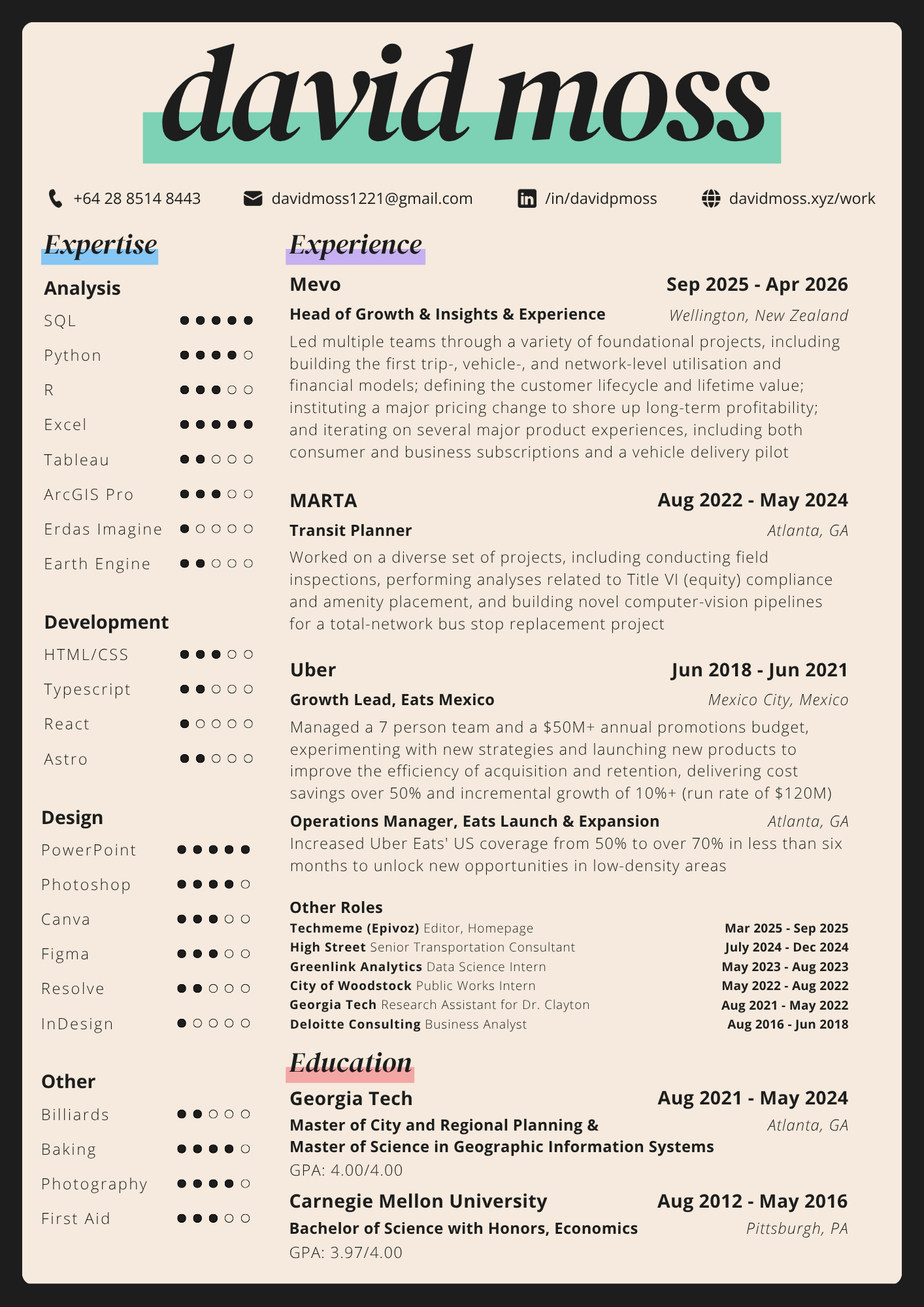
David Moss's résumé, as an image. The readable text version is the PDF linked above.

Projects

What I've done that's worth sharing

Redefining Food Deserts

Redefining Food Deserts

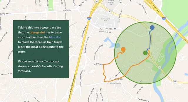
Self-selected research project that served as the thesis for both of my master's degrees, exploring the issues surrounding food deserts (i.e. areas with low accessibility to grocery stores). It was an expansive effort that tackled two core issues: the shortcomings in how food deserts are commonly defined, and why simply "building more stores" is bound to fail to tackle the root cause of the problem.
Matplotlib Map Utilities

Matplotlib Map Utilities

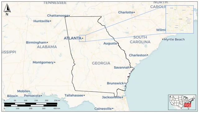
A Python package I created that helps users create common map elements for maps made via the popular Matplotlib graphics library. The package includes easy-to-use functions for creating north arrows, scale bars, and inset maps and their related indicators, all of which are "geospatially aware", so that aspects like the size of the scale bar and the rotation of the north arrow could be automatically imputed instead of declaratively fixed.

Climate Vulnerability Studio

Climate Vulnerability Studio

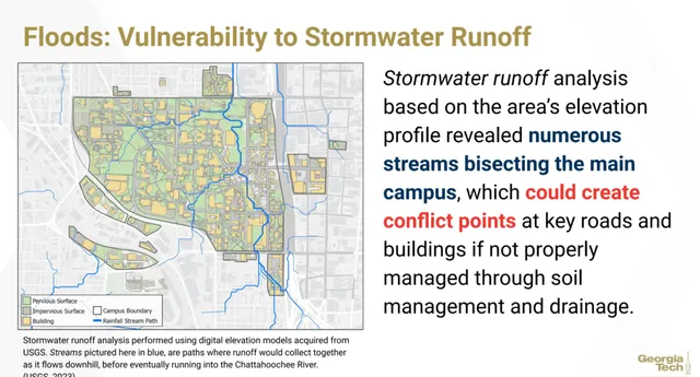
As part of a larger studio group assessing Georgia Tech's vulnerability to climate-change induced extreme weather, I led the analysis of potential heavy rainfall-induced flood vulnerabilities. Ultimately identified several conflict areas from stormwater runoff and stagnant pooling, and a list of recommendations for how to strengthen campus resiliency.

Tactical Bus Seat Installation

Tactical Bus Seat Installation

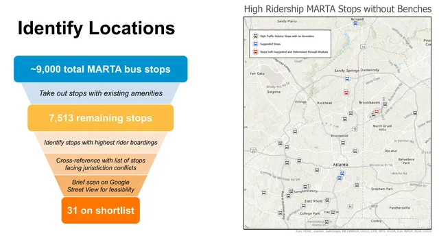
A group act of "tactical urbanism", i.e. changing the built environment in some way to benefit the community by focusing on short-term, low-cost interventions, in this case by installing seating at certain high-volume bus stops that currently lack such amenities due to jurisdictional or budgetary limitations on MARTA's behalf, with the goal of increasing ridership and improving public perception of the bus system in Atlanta.

MARTA BSRU Oversight Apps

MARTA BSRU Oversight Apps

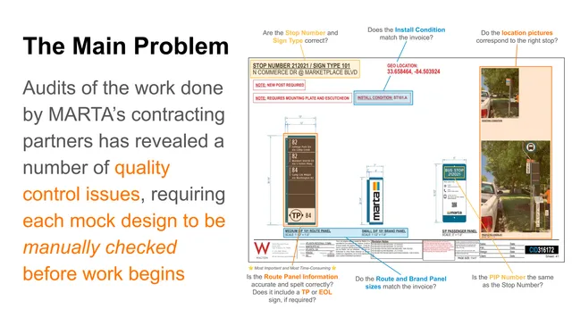
Two tools developed to expediate the Bus Stop Replacement-Upgrade (BSRU) workstream at MARTA. The first generates KML files that could be fed into Google Earth, allowing for easy verification of GPS coordinates and street view imagery compared to manual methods. The second uses Python to extract information provided in PDF files, which is then compared to a source of truth file to identify discrepancies.

Regional Rail Analysis

Regional Rail Analysis

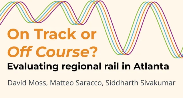
A network analysis of the ATL Trains (opens in a new tab) regional rail proposal, quantifying the competitiveness of the underlying vision for a far-reaching, integrated train network against traditional car-based travel. Our group was able to access several unique datasets to model commuter travel times and determined a surprisingly high proportion of trips would be competitive.

Woodstock Traffic Solutions

Woodstock Traffic Solutions

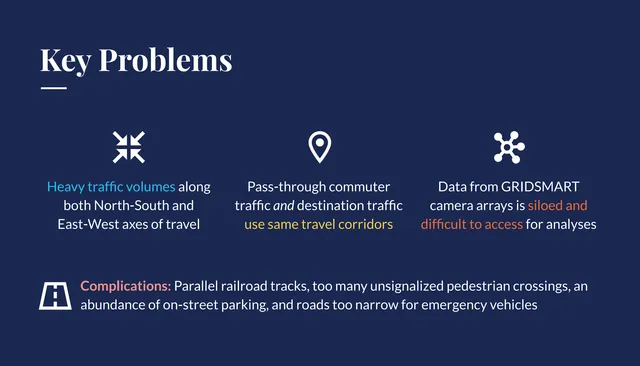
Work done during an internship for the City of Woodstock, Georgia, to identify the root-cause of Woodstock’s congestion issues in their main downtown corridor, and weigh potential solutions to those issues, such as smart traffic lights, as well as sources of data that might help city leaders better understand the problems.

Entrepreneurship Research

Entrepreneurship Research

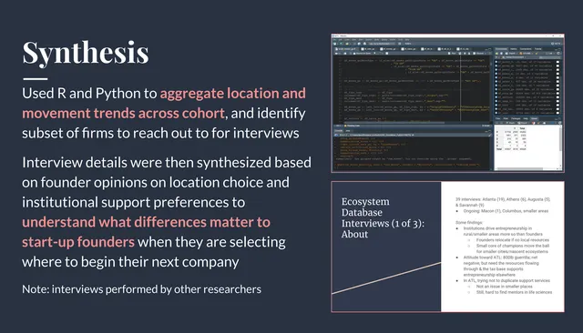
Research done with Dr. Paige Clayton, whose work focuses on innovation ecosystems, attempting to understand what local institutions can do to provide support to entrepreneurs, especially those in highly technical domains. Together, we analyzed and synthesized data sources that tracked companies longitudinally so that we could aggregate and identify trends and interview key founders.

Train Station Redesign

Train Station Redesign

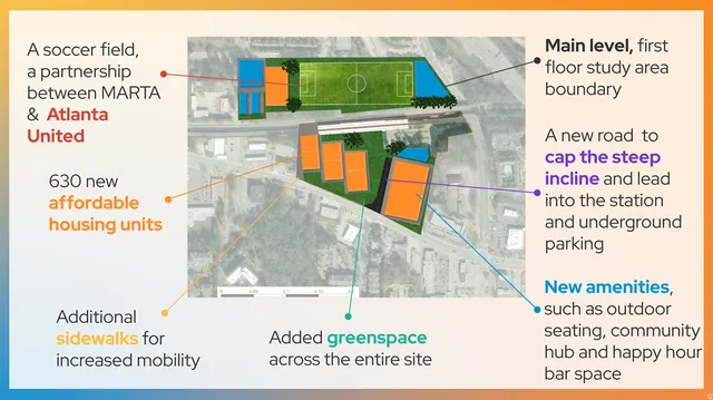
A redesign of HE Holmes, a station on the MARTA rail network to the west of Atlanta, to comply with Transit-Oriented-Design principles. Our group re-imagined the space by moving the underutilized parking underground, and proposed the construction of affordable housing, local retail, greenspaces, and community centers above.

Long-Haul Electrification

Long-Haul Electrification

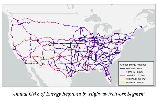
An investigation into the question of whether or not long-haul trucking could be fully electrified and powered through locally-generated solar energy. The analysis synthesized numerous GIS-based techniques, including geocoding, raster summarization, vector planarization, shortest-path routing and route overlining, as well as map creation.

Complete Streets Redesign

Complete Streets Redesign

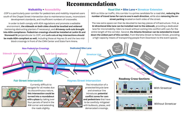
A redesign of HE Holmes, a station on the MARTA rail network to the west of Atlanta, to comply with Transit-Oriented-Design principles. Our group re-imagined the space by moving the underutilized parking underground, and proposed the construction of affordable housing, local retail, greenspaces, and community centers above.

Pandemic Ridership

Pandemic Ridership

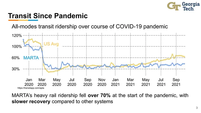
A project focused on quantifying how rail ridership changed in Atlanta as a result of the pandemic, focusing on three one-week time periods: before, immediately after, and a year after the pandemic started in earnest. My role was to analyze the BreezeCard ridership data that we had received from MARTA in Python, aggregating it to measure how much passenger throughput had changed over time.